Quick Guide to SUPing the American River
In the heart of “gold-country,” the three branches of the American River provide reliable, year-round whitewater opportunities to paddlers in the Bay Area of California and the surrounding region.
Their headwaters are high on the western slopes of the Sierra Nevada mountains; their westward course is sandwiched between the I-80 corridor to the North and the Highway 50 corridor to the south, connecting the Reno/Tahoe Basin to the Sacramento Valley; and their flow is collected at Folsom Reservoir near the city of Auburn, CA where the main stem of the American River continues on.

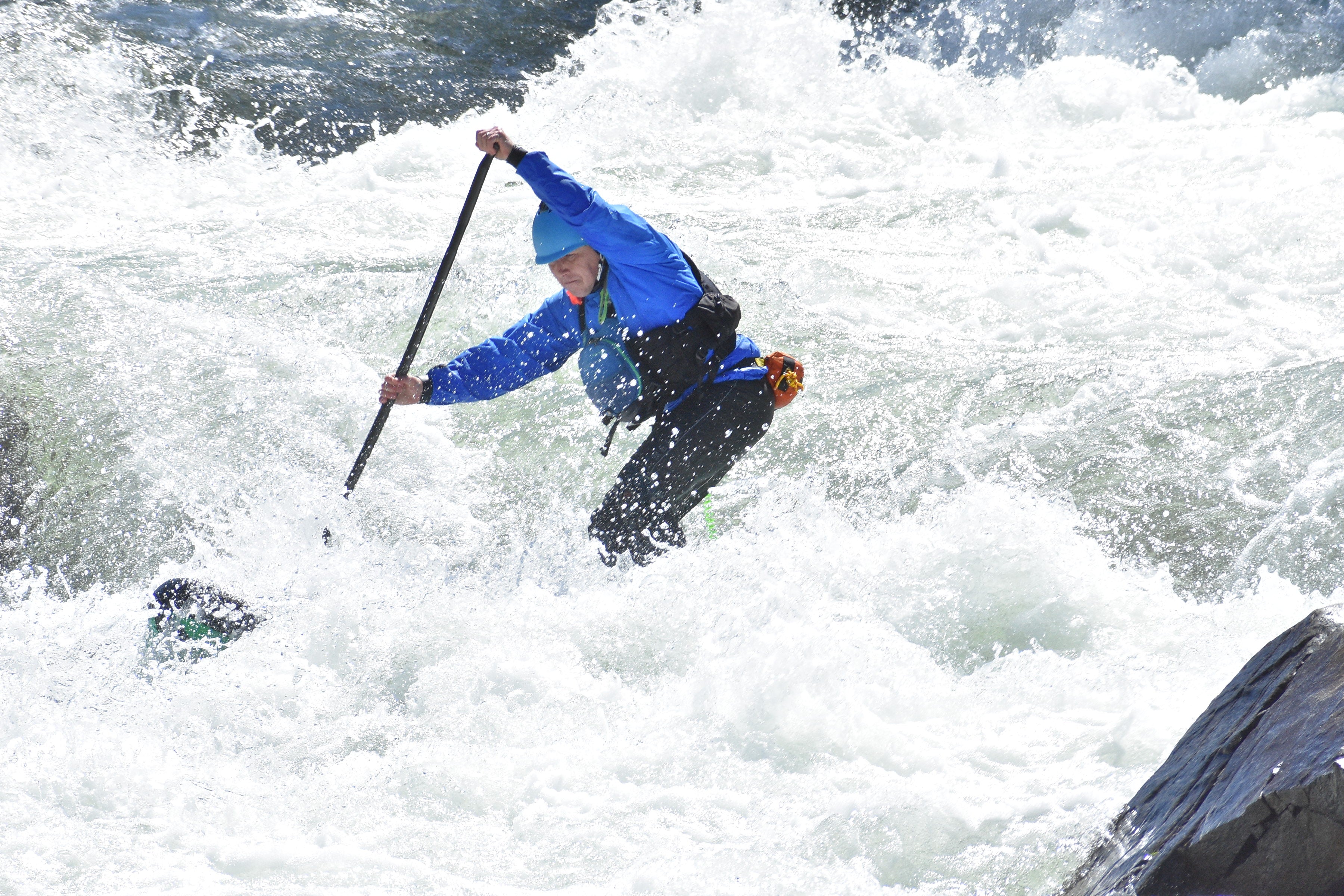
This blog focuses on the class II-III sections of the American River, which is the most enjoyable for the up-n-coming whitewater SUPer.
From extreme class V runs to mellow class II stretches, the branches of the American River offer something for every level of paddler. The three branches are the North Fork, the Middle Fork, and the South Fork; the latter is the most well known, most heavily used, and also the most easily accessible of the three.Shirttail Run - North Fork of the American River (class II+)

This gorgeous un-dammed 9-mile run is in deep drainage with interesting rock formations, engaging rapids, and surprisingly clear and cold water. Flows are totally dependent on snowmelt and are typically in the ideal range during late Spring. Put-in at Yankee Jim Bridge and take-out at Upper Clementine Reservoir, all while enjoying the festivities of the revelers that frequent these shores.
Access to Upper Clementine is often closed until Memorial Day weekend, so paddlers wishing to do this run earlier in the season will either need to take out at Ponderosa bridge (5 miles into the run) or at Lower Clementine, which adds 3 miles of flatwater paddling to the float.
Driver’s Flat Road to Mammoth Bar - Middle Fork of the American River (class II+)

Flows on this run are controlled by Oxbow Dam located 15 miles upstream of the Driver’s Flat put-in. Late risers can happily sleep in because it takes approximately 5-6 hours for the water to travel down from Oxbow and reach the put-in, so a later start is preferred.
If you paddle this stretch of the river be sure not to miss the takeout, as the aptly named and dangerous Murderer’s Bar rapid lurks not far downriver and around the bend.
Confluence Run - North Fork of the American River (class II-III)

Flows on this run are affected by two dams: the limited release from North Fork Dam, just upstream of the put-in, and Oxbow Dam on the Middle Fork approximately 25 miles upstream of the confluence. Options for extending the run exist during times when the water level of Folsom Reservoir is lower.
Coloma to Greenwood - South Fork of the American River (class II+)
A major highlight of this run is Barking Dog, the premier standing wave of the area, located just downriver from Camp Lotus. Even on an off-season day, one can find company here. Put-in at the Coloma North Beach, which also serves as the take-out for the classic class IV Chili Bar run, and take-out at Greenwood Creek.
Winter paddlers, you’re in luck as flows on this run are regulated year-round by the recreational release from Chili Bar Dam; weekend paddling is possible even while there is snow on the Sierra passes. It takes approximately 2-3 hours for the water to travel the 7 miles down from Chili Bar and reach the put-in. Fast paddlers can easily take multiple laps on this run, even on days when the release lasts only a couple of hours.
The Gorge - South Fork of the American River (class III)

Put-in at Greenwood Creek and take-out at Skunk Hollow. Also regulated by Chili Bar Dam, it takes approximately 4-5 hours for the release to reach the put-in at Greenwood. This run can easily be extended by putting in at Coloma North Beach for a full-value day on the river.

Some additional useful logistics:
- Ideal flows for SUPing these runs range between 1,200-1,800 cfs.
- A great resource for gauging flows is DreamFlows. The site also provides recreational release information for Oxbow and Chili Bar dams.
- Access to the North and Middle Forks above their confluence typically requires travel on dirt roads where a high clearance and AWD/4WD vehicle is recommended. Additionally, most of the access points are within California State parks and require a day use fee to park.
- On the South Fork of the American, a private boater shuttle can be reserved with the Coloma Shuttle.
- The cities and towns of Auburn, Foresthill, Coloma, and Placerville provide amenities for paddlers from out of town. Sacramento has the closest major airport just one hour away.
Leave a comment
This site is protected by hCaptcha and the hCaptcha Privacy Policy and Terms of Service apply.