Hell or High Water: How to Read a River Gauge
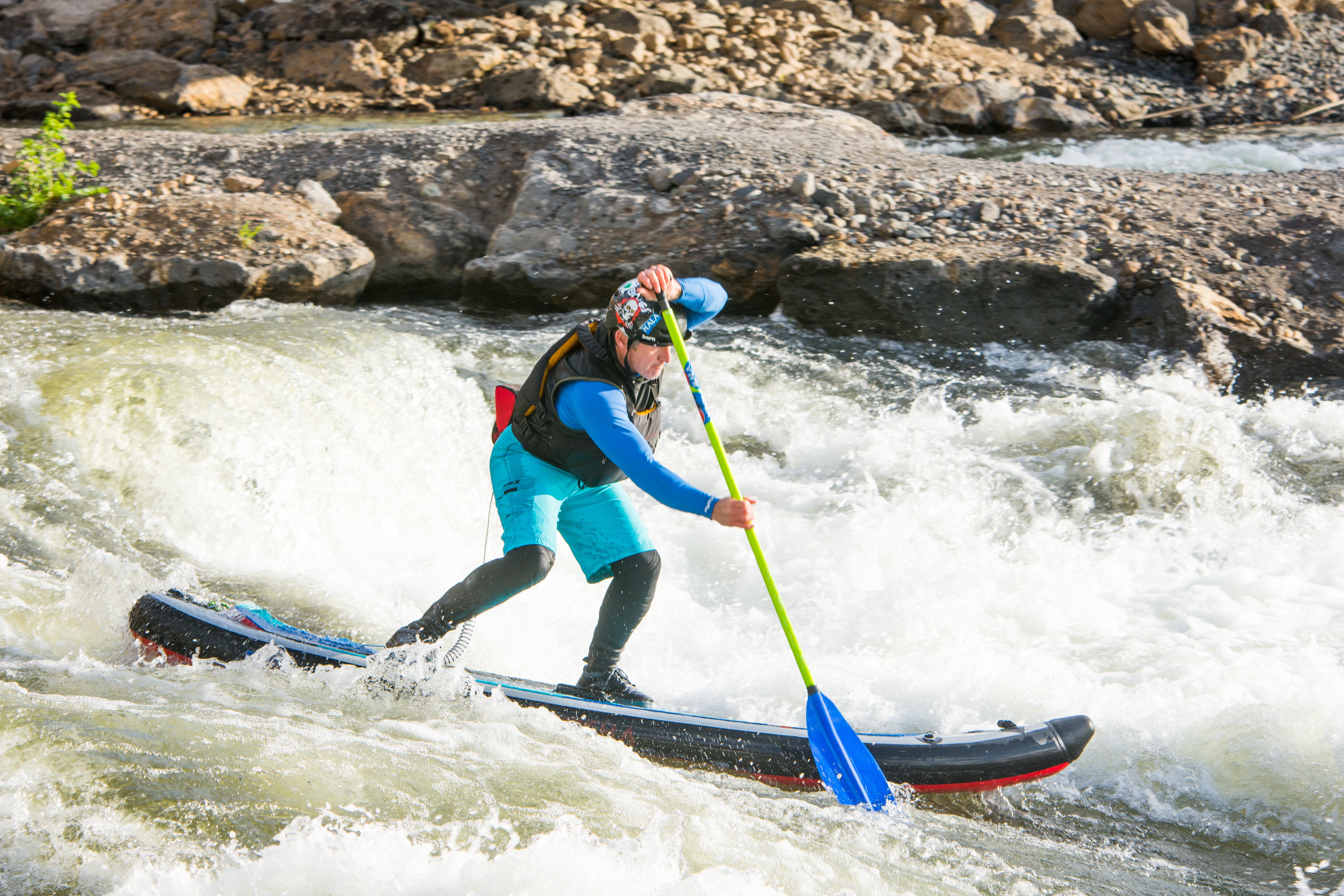
It's that time of year again! River folk of all ages and disciplines are checking their phones and updating their web browsers en masse to watch river levels ebb and flow. Hala team rider Matt Buckley gives us the rundown on how to find this information, dispensing all his tips and tricks so that you can make plans to SUP new runs or crush old favorites.
When I was tender footed whitewater guide, I was lucky enough to live amongst a community of like-minded souls in the dusty parking lot of a river outfitter, mere yards from the banks of the Arkansas River. Seasoned guides could approximate a river’s flow by judging how covered or uncovered a certain rock was. As a rookie, my modest affinity with the Arkansas meant I had to wait for the head boatman to open the boathouse and write the metrics on the board.
I wondered, out loud, where he got those numbers from, and a few snide remarks later I finally discovered that the United States Geological Survey (USGS) maintains a website that systematically tracks water all over America.
In the United States, we refer to river flow in two ways: cubic feet per second (CFS) or feet (height). CFS is the most common, however, some rivers are measured in feet due to a lack of a river gauge. For all intents and purposes, they assess the same thing. As a recreation user, neither CFS or river height will be meaningful until you get a sense of what constitutes high or low water on a given run. Additionally, since every river has a different character, it is important to note that some sections of a given river take less water than others to become runnable. The Yampa River moving at 5,000 CFS is very different from the Upper Colorado River moving at 5,000 CFS. Therefore, in order to appreciate river gauge measurements, you must paddle frequently and ubiquitously!
Where can you find these measurements? There are many available resources, however, I like to keep things simple. I will stick to two organizations that have served me really well for years. Both institutions manage websites that provide river data for the entire country.
Up first is the USGS.
This link brings us to the National Water Information System homepage. My go-to way to search for river gauge information is through the Current Conditions button. If you choose this module, you will find a US map with several colors keyed down on the bottom right. Click on the state in which the river stretch you want to know about resides. On the right, you will see “Streamflow Real-Time Table” listed. You will now be looking at a long record of all the gauges in that state separated by drainage with at height and CFS measurements listed. Find the gauge for the stretch you want and click on it for a more detailed look at what's happening. On the main page for each individual gauge, it will show a height and CFS graph from a few days prior up to the current day. At some gauges, this data is updated several times a day. Different parameters can be selected or entered to see specific flow histories or data. I like to run the gauge history for previous years and try to predict flows.

I also use the map search function on the National Water Information homepage. Click the button that looks like a map, and you will be brought to, of all things, a map. A search function exists on the right side of the page with a filter option. This map and its corresponding query have allowed me to look at any river I was curious about SUPing, find the stretch of whitewater I wanted to play on, and locate the closest gauge. Obtaining this knowledge before running a river was crucial, as it helped dictate when I should put-in.
Next up is American Whitewater (AW). This non-profit is filled with warriors who fight on the behalf of rivers and the champions for boater’s rights in the US. Consider a contribution, if it strikes your fancy.
At the top of the screen, you will see several tabs. Click the “River Info” tab and it will bring you to a map of the US and a list of states. Run down the list, find the state where the river you are interested in flows, and choose “Drainage Summary.” Drainage summary will help you understand what rivers flow together to constitute a drainage, which can be key when interpreting flow. Drainage summary will group nearby flows, which is helpful if you are looking for a neighboring run. AW’s Drainage Summary list is similar to USGS, but it is organized a little differently and cleverly includes some other metrics. This is the magic of the AW site at work. Rivers are organized not only by drainage but by stretch. Unlike USGS, you don't need to know the gauge for the stretch - AW has already linked them!
As you look at a stretch you will see a ton of info in one glance. First off, colors! Up top, you will see the color key. Only care about what is flowing well? Scroll down and only look at what is highlighted in green. AW loosely interprets optimal flows, so you might find you can still SUP well beyond “Below Recommended” and well past “Above Recommended.” Regardless, AW provides a great guide to finding the flows you're after.

Next, you will notice an attempt to classify the difficulty of the run. Again, AW provides broad guidelines, however, this is a great way to view what rivers have good flow and are within your paddling abilities.
AW also provides CFS data. This typically comes straight from USGS and, in my experience usually, updates within minutes of the USGS gauges. You can also see how much time has elapsed since the last update.
Finally, when you click on the stretch, even more amazing information is provided. Although it varies from river to river, often times AW will outline recommended levels, gradient, mileage, run descriptions, rapid descriptions. Photos are occasionally provided.
Phew, that's enough of that. I'm going to go back to obsessively checking gauges so I don't miss out on a paddling opportunity. As a friendly reminder; don't be afraid to seek training, choose your gear carefully, choose your paddle partners carefully, know your limits, research runs you've never paddled before and try to pack the maximum amount of fun into every paddle!
Matt Buckley is a team rider for Hala Gear.
Leave a comment
This site is protected by hCaptcha and the hCaptcha Privacy Policy and Terms of Service apply.